Heywhatsthat and Radio Mobile Online!
Coverage prediction software is nifty and handy, the internet and powerful computers have made the availability of predicting coverage footprints for transmitters and the visible horizon from any location on the globe really easy.
A number of simple software packages that let you predict these items are Hey Whats That http://www.heywhatsthat.com/ and Radio Mobile Online http://www.cplus.org/rmw/rmonline.html. I’ve written before an into to Radio Mobile, and you can see that again here the below is a quick intro to Hey Whats That, it offers similar functions and features to radio mobile, but in its simplest form is just a Line of Sight tool! good for microwave antenna pointing or, its original application, “”Hey, whats that”” lump of dirt in the distance!! Its pretty nifty.
Head to the website and pick your location (you can specify your height above ground (say 12m for your antenna!) I choose a sample one from the lookout at Mt Dandenong and you can see the results below. Choose your location and hit run. 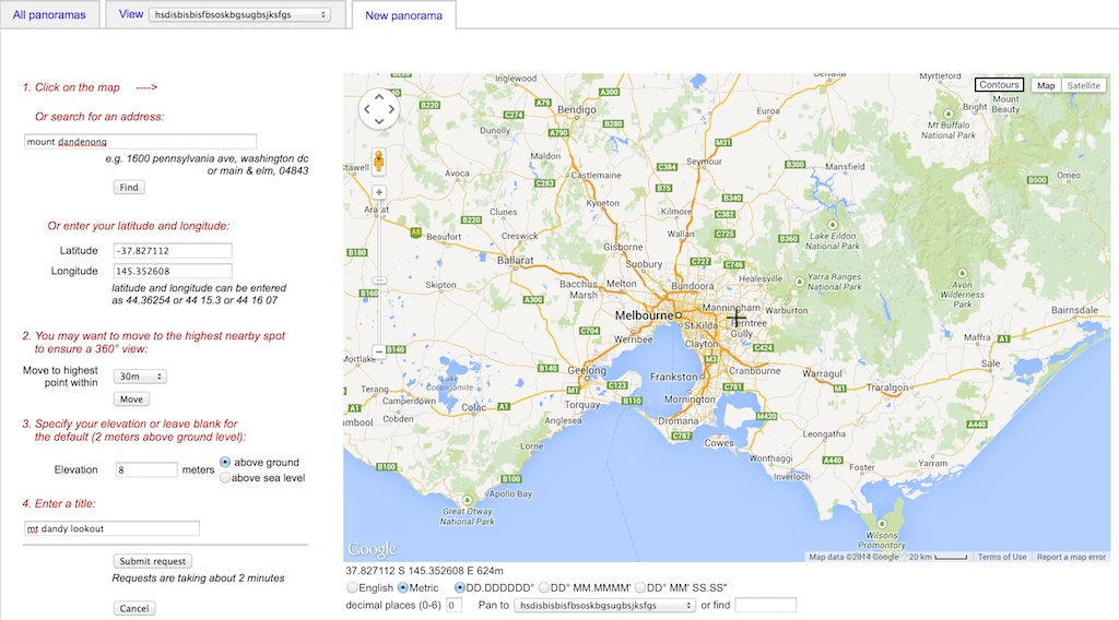 Soon after, the page comes back with the results. At the top shows line of sight view, and a path profiler if you pick a spot on the view
 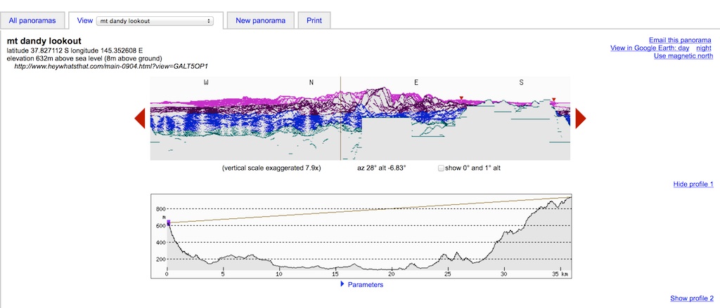 And the map version, the red overlay shows what you can physically see!
 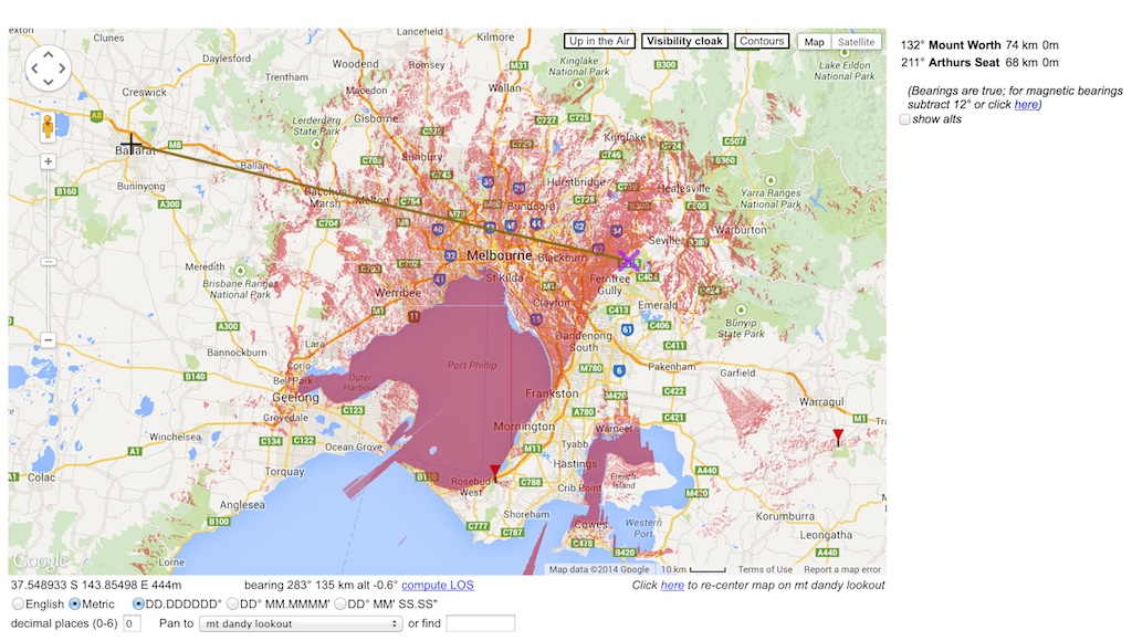 One of the options is to export the visibility view into google earth, it downloads the .KML file and lets you see it in that software, it looks like this
 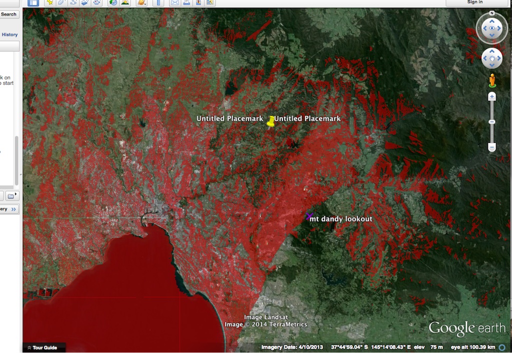 One last feature it offers is a path profiler tool (similar to Radio Mobile) you can choose and A and a B location, even specific a frequency to show you the Fresnel zone expected on the nominated frequency.
 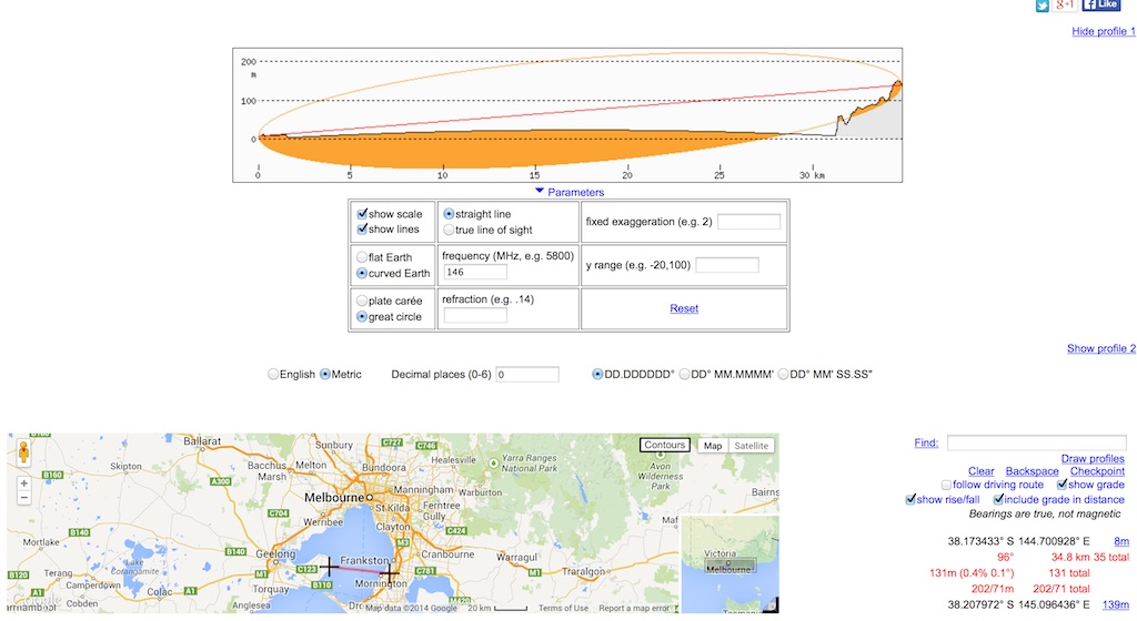 My example prediction from Mt Dandenong can be viewed at http://www.heywhatsthat.com/?view=GALT5OP1
AND…..
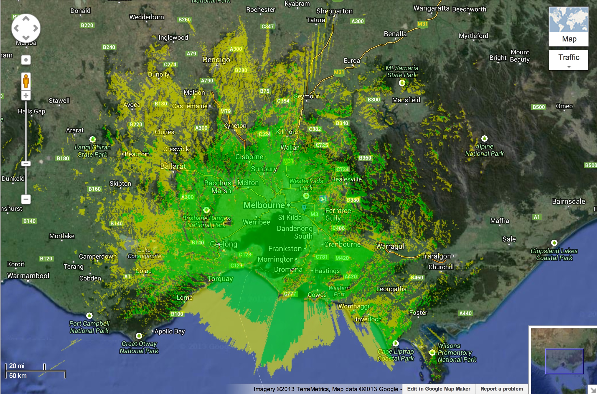
A nifty freeware bit of (windows) software for hams and other radio people is called “Radio Mobile”. This tool allows you to simulate and map predicted coverage of your location using terrain and clutter data and maps expected coverage into google maps.
The windows version requires you to source the terrain and clutter data (easy to find) and allows you to map your footprint locally on a pc, (which i don’t have anymore being a mac house) I use commercial software to do this type of thing in my day job, designing and optimising a mobile telephone network. That software is worth tens of thousands (if not hundreds of thousands of dollars) we use much more detailed terrain data and better clutter, we also spend a lot of time modelling antennas and ensuring the predictions match the network.
Im not sure why I looked the other week, but discovered radio mobile had gone online. This online version uses its own local terrain database (so you don’t have to find one) and lets you modify the parameters and map your coverage footprint, most features of the downloaded-able version are available online, BUT it happily works on my MAC, including the ability to map coverage, and predict a path/link loss, and model antennas. You can choose the detail in terrain and clutter data, a high res analysis takes around 2 mins with the server doing all the work. Spitting out a KML file at the end you can display online on google maps or download into google earth.
Having had a bit of a play with radio mobile online. I agree with the general predictions. Im on the edge of a ridge and have a very good view for ~300 degrees looking south and west. From my roof, I can see the city. Only blocked to the North East, and then only by another 20m of terrain before the surrounding hills. Below is a prediction from my home with my 146MHz omni at 10m and 100w FM. Have a play online and see how your courage footprint looks. 😀